Agronomeye – Digital Foundation
Agronomeye’s open and collaborative approach is enabling us to deliver best-in-class analytics through our Digital Foundation while partnering with other leading businesses in the agricultural sector to visualise their valuable information in our unique platform.
These highly accurate 3D models allow for a number of critical management decisions to be data driven including:
- Water Management
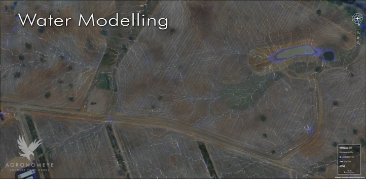
- Centimetre accurate elevation data enables water flow modelling to determine a number of issues including erosion risk, catchment location efficiency, surface water runoff etc.
- Redevelopment Proposals – the same data set can be used to determine financial feasibility of development works including field configuration, earthworks, tree planting in horticulture etc.
