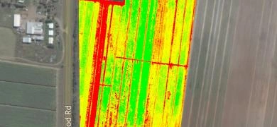
Agrispatial Mapping
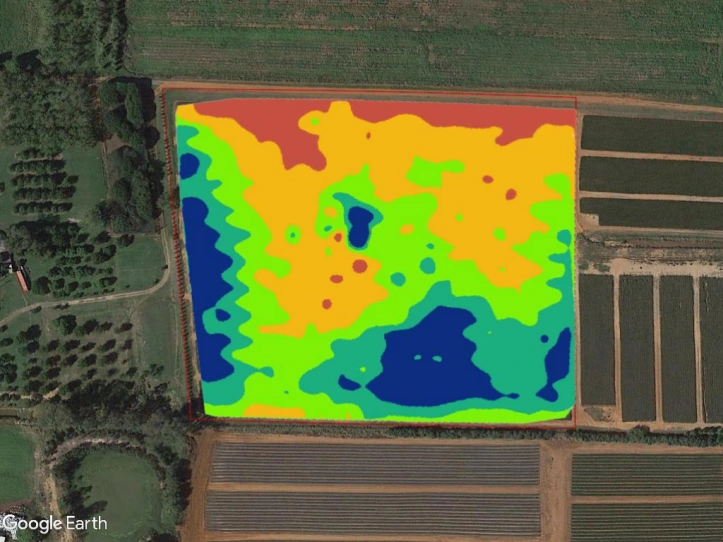

Agrispatial Mapping is a suite of GIS mapping products designed to assist growers and agronomists to better manage their farms and paddocks.
It consists of a set of optional data layers beginning from the sub-soil layers and progressing, where appropriate, to the canopy layer. It provides advanced data for zonal management of land based on:
- Soil quality
- Nutrient retention
- Sun exposure
- Wind exposure
- Drainage patterns
- Growth patterns
- Yield records
- Crop health
- ground cover health
And more.
