Aerometrex
Aerometrex is an ASX-listed Australian company that specialises in aerial surveying and the generation of spatial data from imagery and LiDAR which is recognized among the best in Australia.
Their data can help farmers & landowners gather accurate information about their land, crops, soil, and environment.
This information can help optimise agricultural practices and decrease environmental impact by providing landowners with a holistic three-dimensional model of their property.
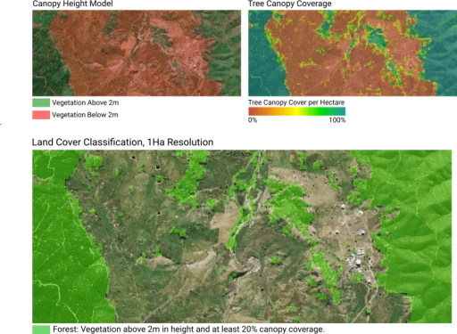
Aerometrex specialises in capturing high accuracy, coherent LiDAR and Aerial Imagery data at large scales. A wide range of datasets that describe topography, vegetation and infrastructure across the landscape can be combined in numerous geospatial platforms to help inform land management strategies.
Aerometrex works with various associations and partner organisations to deliver end-to-end solutions for driving efficiencies within the agricultural sector.
Aerometrex Products (1)